
Dosya:Map of USA highlighting Hawaii.png

No disponible a mayor resolución.
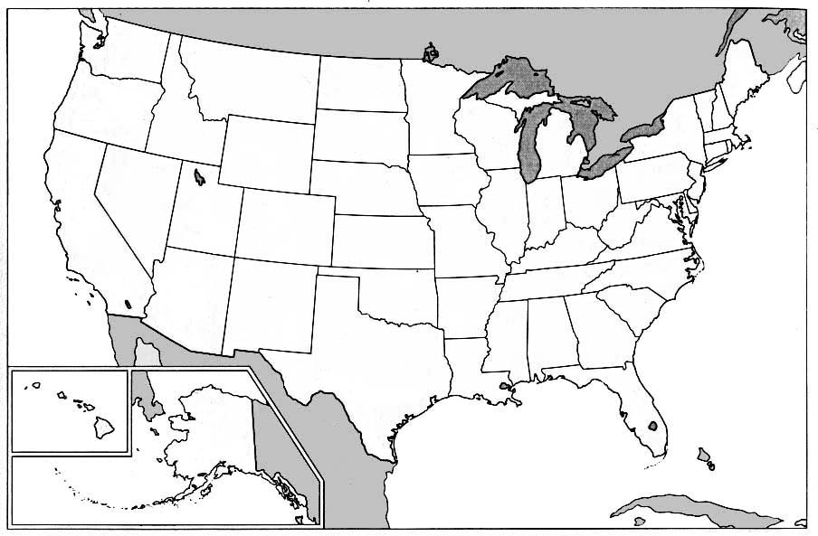
Map_of_USA_highlighting_Hawaii.png (280 × 183 píkseles; boy de la dosya: 35 kB; tipo MIME: image/png)

|
File:Map of USA HI.svg es una versión vectorial de este archivo. Debería usarse esa versión en lugar de este archivo PNG, cuando sea mejor.
File:Map of USA highlighting Hawaii.png → File:Map of USA HI.svg
Para más información, lee Ayuda:SVG. |
 |
Rezümé
Public domain map courtesy of The General Libraries, The University of Texas at Austin, modified to show counties. Released under GFDL. See en:Wikipedia:U.S. county maps
Source: Modified version of United States (Outline Map) 1998 from Perry-Castañeda Library Map Collection: United States Maps
Lesensiamyénto

|
Se autorisa la kopia, distribusyón y modifikasión de este dokumento bajo la GNU Free Documentation License, Versión 1.2 o kualquier versión publikada por la Free Software Foundation; sin kapítolos invariables, tekstos de portada, ni tekstos de kontraportada. Una kopia de la lisensia es inkluida en un kapítolo yamado GNU Free Documentation License. |
| Esta dosya está lisensiada bajo la lisensia Creative Commons Attribution-Share Alike 3.0 Unported. | ||
| ||
| Esta etiqueta de licencia fue agregada a este archivo como parte de la actualización de la licencia GFDL. |
Upload history at other projects
- WP:IT — Hawaii-Mappa.png
- 14:11, Set 10, 2004 . . Klenje (35840 bytes) (Public domain map courtesy of [http://www.lib.utexas.edu/ The General Libraries, The University of Texas at Austin], modified to highlight state boundaries. Released under GFDL. {{GFDL}})
- WP:NL — Locatie Hawaii.png (source)
- 20 nov 2003 11:57 . . Kristof vt (35840 bytes) (uit engelse wiki Public domain map courtesy of [http://www.lib.utexas.edu/ The General Libraries, The University of Texas at Austin], modified to show counties. Released under GFDL. See Wikipedia:U.S. county maps)
- WP:NO — Hawaii kart.png
- 24. nov 2004 kl.01:43 . . Profoss (35840 bytes)
- WP:PL — Map of USA highlighting Hawaii.png
- 07:56, 11 lis 2004 . . Balcer (35840 bajtów) (Hawaje - mapa, z angielskiej Wiki)
La istoria de la dosya
Taquea (pisa con el ratón) encima de una data/ora parâ ver como era la dosya en esta data.
| Data/Ora | Miniatura | Boy | Usador | Esplicación | |
|---|---|---|---|---|---|
| corriente | 02:12 14 may 2005 | | 280 × 183 (35 kB) | Get It | Public domain map courtesy of [http://www.lib.utexas.edu/ The General Libraries, The University of Texas at Austin], modified to show counties. Released under GFDL. See en:Wikipedia:U.S. county maps {{GFDL}} ==Upload history at other projects== * [ |
Usos de la dosya
No ay hojas con atamientos a esta dosya.
Uso global de la dosya
Las vikis siguientes usan esta dosya:
- Uso en br.wikipedia.org
- Uso en el.wiktionary.org
- Uso en en.wikipedia.org
- Uso en en.wiktionary.org
- Uso en es.wikipedia.org
- Uso en fa.wikinews.org
- Uso en fr.wikinews.org
- Uso en hr.wiktionary.org
- Uso en ig.wikipedia.org
- Uso en ku.wiktionary.org
- Uso en kw.wikipedia.org
- Uso en lij.wikipedia.org
- Uso en li.wikipedia.org
- Uso en nl.wikipedia.org
- Uso en no.wikipedia.org
- Uso en no.wiktionary.org
- Uso en pt.wikipedia.org
- Uso en qu.wikipedia.org
- Uso en ro.wikipedia.org
- Uso en sah.wikipedia.org
- Uso en scn.wikipedia.org
- Uso en sv.wikinews.org
- Uso en ug.wikipedia.org
- Uso en uz.wikipedia.org
- Uso en yo.wikipedia.org
- Uso en zh.wiktionary.org